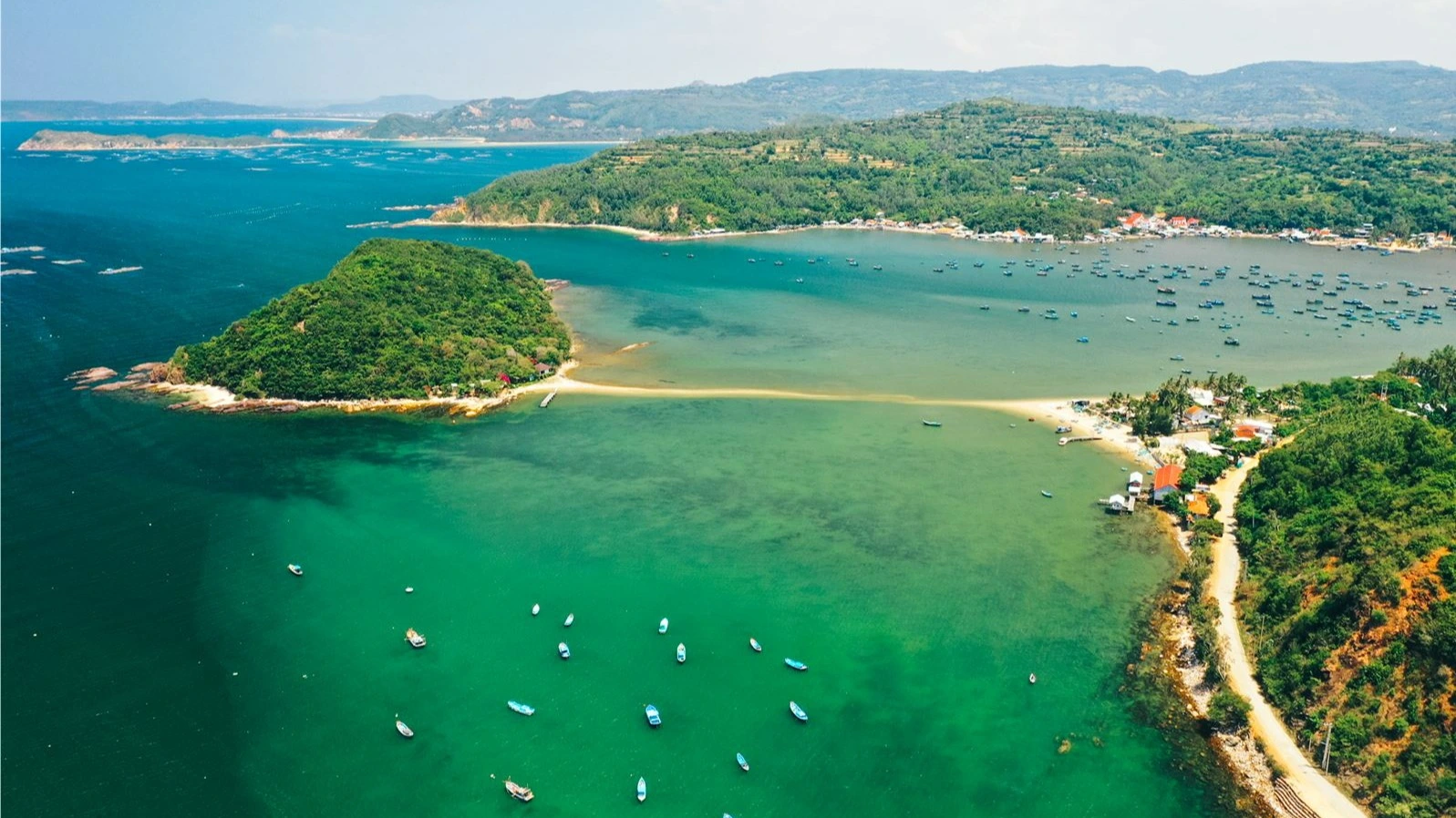
Nhat Tu Son is a small island with an area of about 6 hectares, located at the mouth of Xuan Dai Bay, on the territory of Xuan Thanh ward, south of Song Cau town, Phu Yen province. The special feature of this island is that visitors can walk on a dirt road about 300 meters long leading from the mainland to the island.
Move
Starting from Tuy Hoa city , you move north for about 40km to Chanh Nam village . Currently, the island is available on Google maps, so you can look up and find directions easily. When you are close to Nhat Tu Son , you should park your car on the mainland to experience walking through the island through a long road under the sea Range 300m
In summer, you should go to the island early in the morning, the tide has not receded, it only takes about 5 minutes by canoe to get to the island. The ticket price is 50,000 VND/person with a bottle of drinking water.
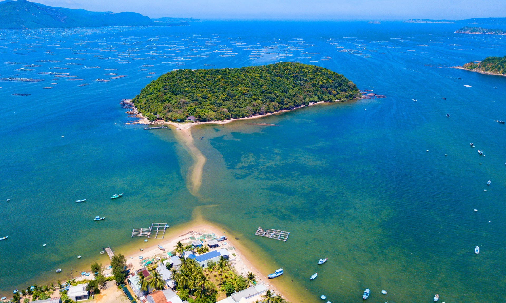
Photo: Thanh Nhan
What to bring
There are almost no tourist services on the island, only a souvenir and refreshment stall for visitors. The island is uninhabited, only forests, rocky beaches, white sand, golden sunshine, wild and deserted scenery. Overnight camping is not allowed on the island, visitors should note to arrange a day tour schedule. Before arriving on the island, visitors monitor the forecast of high and low tide times through phone applications. Then you can go to the island by canoe and walk back or vice versa, depending on when the tide recedes. Visitors should prepare clothes and sunscreen. It is possible to bring food and water from outside to the island, but it is not allowed to litter indiscriminately according to the regulations of the Management Board.
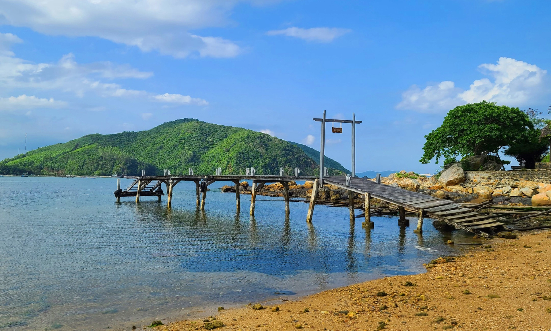
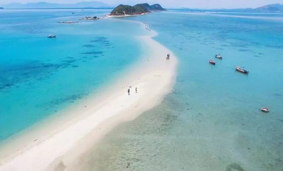
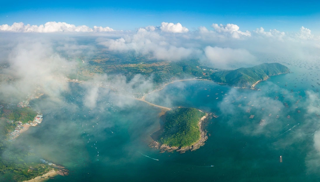
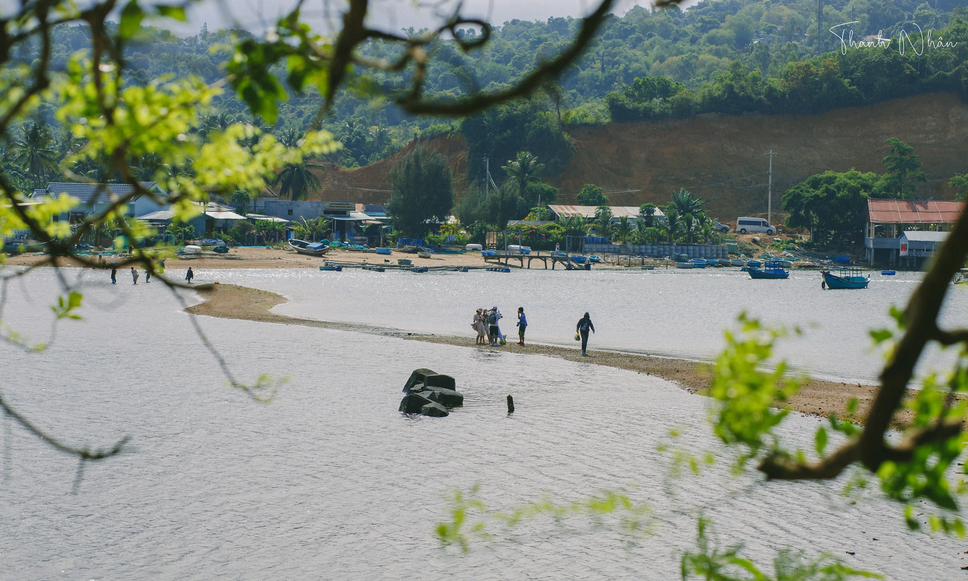
Photo: Thanh Nhan/Le Chi Trung
Activity
According to information from the Nhat Tu Son Management Board, the flora on the island is quite rich. There are many precious wood trees here dating back hundreds of years. The western flank has many mausoleum and oak trees, while in the south there are rugged cliffs and ancient apricot trees. In the east, the surface of the island faces the sea, and the rocks are stacked on top of each other, forming a shape like a seat.
The rocks are located on the edge of the island, running parallel to each other, forming small water gaps. The waves of the sea rushed in, white foam from the water splashed up and carved into small underwater caves. A short distance from the cave, before reaching the road leading to the front of the island is a sandy beach covered with snail shells on the surface.
Standing on the highest point of Nhat Tu Son island overlooking Xuan Dai Bay, visitors will admire the boats, boats, and rafts raising seafood of local people. Just like Song Cau town, Dam Cu Mong, this is also one of the most famous seafood granaries of the country.
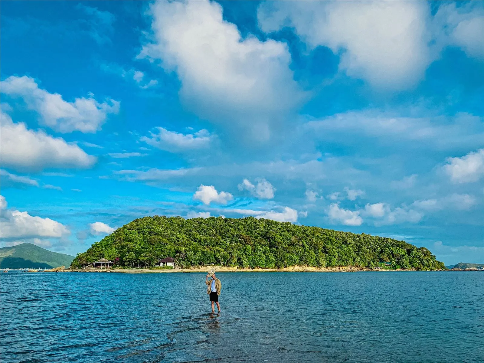
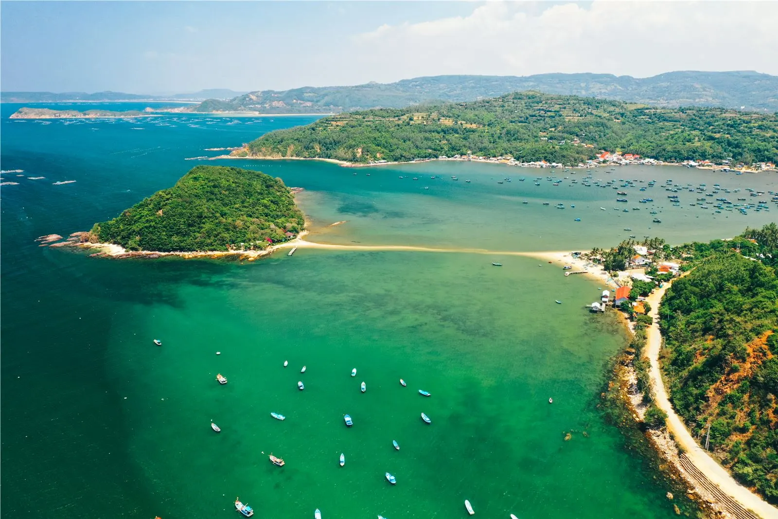
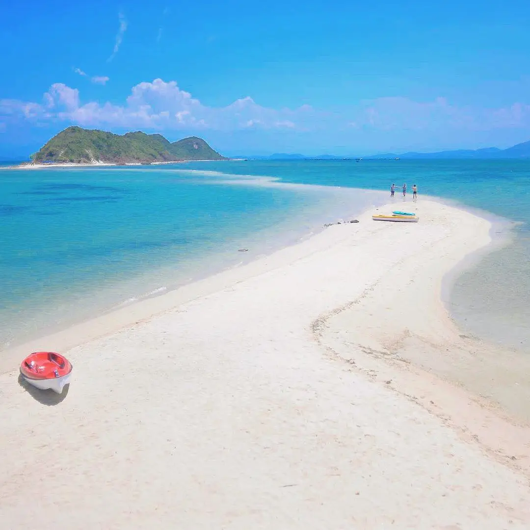
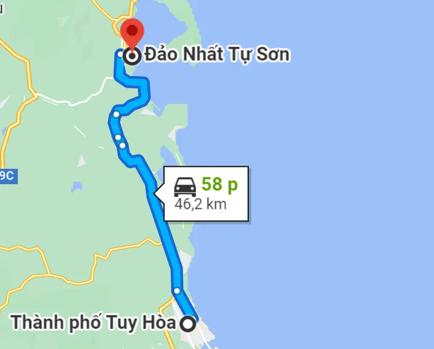
Photo: Ngo Tran Hai An/mui.yb
Above is the blue sky, sunny and light wind, below is the sea water is also a blue color, creating a cool and pleasant scene. At about 2 p.m., the tide began to recede, and the road on the sea was gradually exposed. Wait until the water recedes completely, the width of the road is about 4 m before you can walk back to the mainland from here. The road is the same as the road in the land, but the special feeling is that both sides are seawater. Just walking normally on this road also produces beautiful and unique photos
The ideal time to explore Nhat Tu Son is between March and August. In summer, from May to July is the most beautiful time for Nhat Tu Son. The island is covered by a tree-lined forest, the air is fresh, cool, sunny and windy.
Migo Synthesis