About 120km from the center of Ha Giang city, Chin Khoanh slope (connecting 2 communes of Sung La and Pho Fox) is part of the Bac Sum slope, located on National Highway 4C – the arterial route of Ha Giang province. Not only is it considered the gateway of Dong Van rock plateau, this slope has also become a place where anyone passing by wants to stop and check-in because of the picturesque scenery.
In particular, when standing from the top of the slope looking down, visitors cannot help but admire the green, peaceful and poetic scenery, reminiscent of the image of Switzerland often seen in movies.
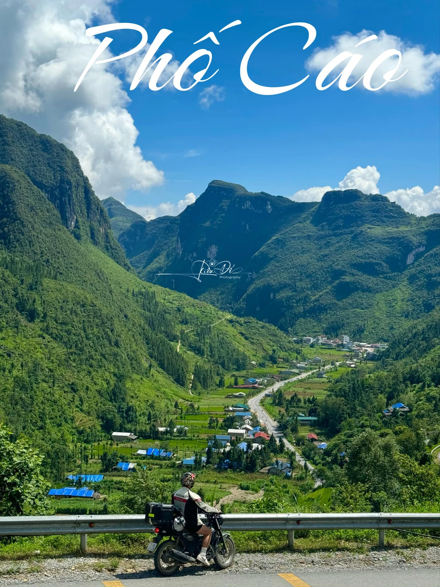
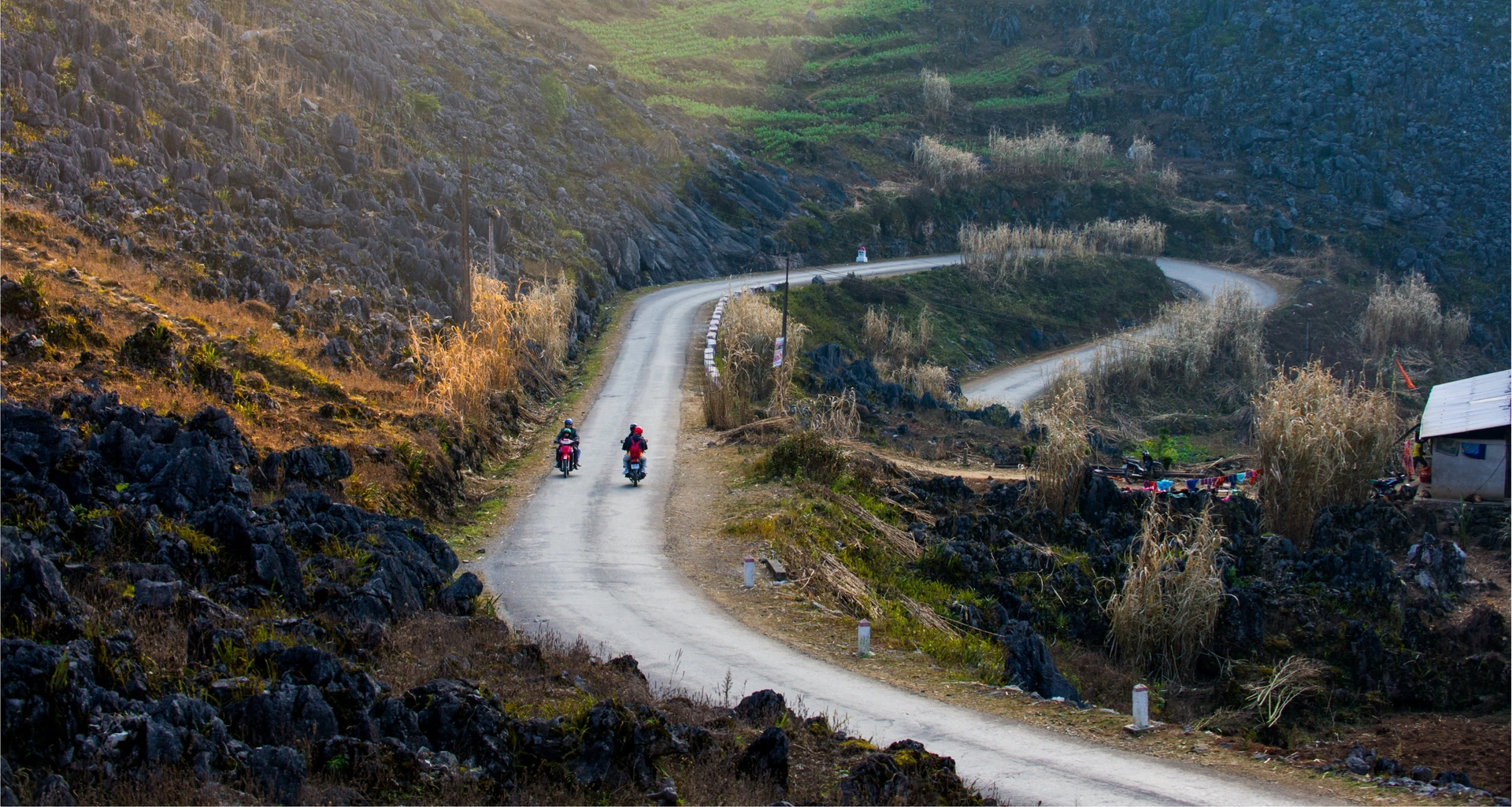
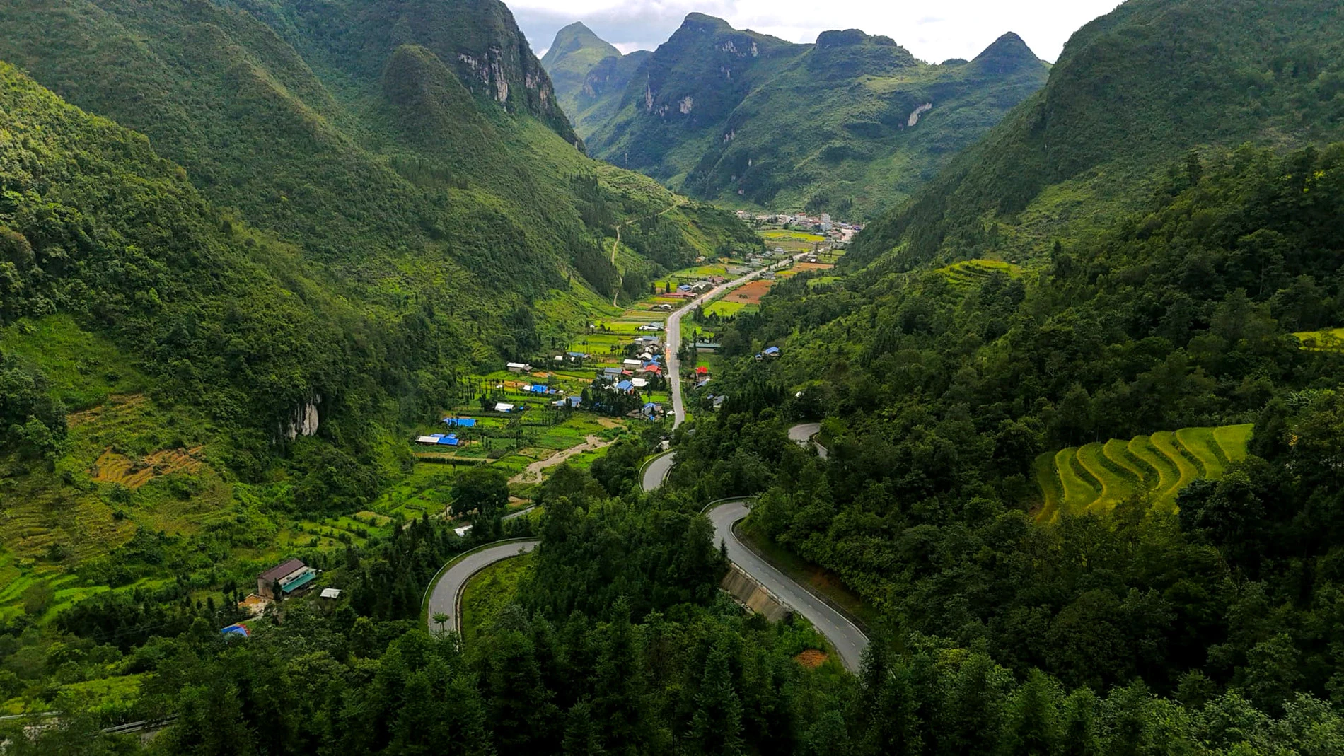
From the top of the slope of Chin Khoanh looking down at Fox Street, visitors see a picturesque scene, reminiscent of the image of "Switzerland in miniature". Although the scenery on both sides of the road is impressive, tourists who have moved through Chin Khoanh slope commented that this is a dangerous road, challenging even "hard-handed" drivers.
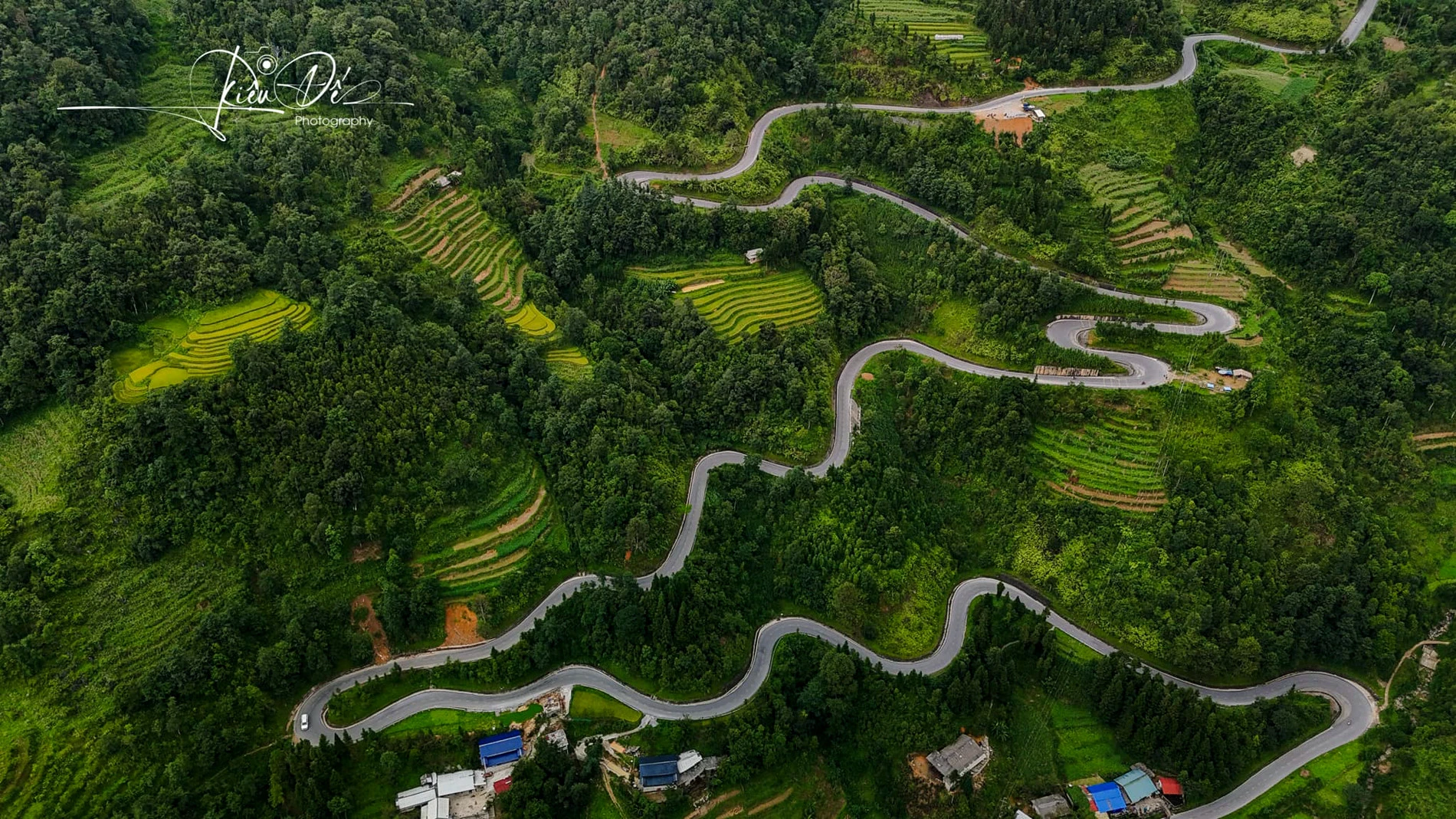
Accordingly, this slope lies steeply in the middle of the mountainside with many sleeve bends, U-shaped bends appearing consecutively. Locals often say that this is a place that "makes horses falter, makes people sore their legs".
Viet Anh – a tourist who has passed through Chin Khoanh slope several times said: "Going down the slope is simple, but getting up the slope is really difficult. Therefore, backpackers still joke that this is Shen Xe slope (test the car).
In addition to the requirement that the motorbike must have a strong engine, you also need to drive firmly to overcome this slope if you don't want to fall into the situation of walking the car or asking other vehicles to pull it to climb the slope. Even experienced drivers when passing here are still wary.
However, when overcoming the famous rugged slope, visitors will have the opportunity to explore many other attractive destinations on the other side of the slope or visit and experience culture and cuisine in 2 communes of Pho Fox and Sung La.
From September to November is the ideal time for tourists to visit Dong Van rock plateau, admire the beautiful scenery on Chin Khoanh slope or welcome the brilliant golden rice season. Besides, there are also many buckwheat fields around Chin Khoanh slope, so if you come here in the last months of the year, tourists can also enjoy taking pictures with this famous flower.
From the center of Ha Giang city, visitors follow Nguyen Trai Street and then enter National Highway 4C to reach Bac Sum slope, taking about 3 hours to travel. This slope is located at an altitude of more than 1,400m above sea level, so when coming to the top of the slope, visitors can feel the cool air and fresh space.
Passing the Bac Sum slope, visitors move to Quan Ba twin mountains and then continue through the Yen Minh pine forest to Chin Khoanh slope. These are all famous check-in locations that visitors can combine experiences before coming to the "gateway of Dong Van stone plateau".
To have a safe and enjoyable trip, visitors need to pay attention to the weather forecast in advance, avoid going over the slope in the evening, at night or moving on rainy and windy days, with a lot of fog and clouds because the visibility is easily obscured.
Besides, you need to check the vehicle carefully before starting, make sure the car has a healthy engine and a full tank of gasoline. You can bring spare gasoline and prepare basic car repair tools.
Photo: Hoang Dieu De
Source: VNN