
Fansipan (3,143m)
Ranked first on the list not to be missed when embarking on a journey to conquer the country's highest peaks, Fansipan is known as the "Roof of Indochina" with an altitude of 3,143m above sea level. Although don't worry about the altitude, the terrain is diverse but not too complicated, the Fansipan climbing arc is said to be relatively easy to go and suitable for those who are new to trekking.
The best time to climb Fansipan is from Autumn September to April after the weather is dry - this is also the perfect time to consider for most Northwest cloud hunting journeys. However, for the best cloud hunting, pay attention to the actual weather and consider starting the journey before winter arrives (around November to November Tet m Calendar) - this is also a time when there is a lot of cold and fog, so the cloud-hunting peaks can be covered with clouds, limiting the beautiful views to the eye.
There are currently 03 road routes operated with different difficulties and departure points for trekkers to choose from, to get the perfect trek for the group, please do not consult with the porter before booking the tour. In particular, the Tram Ton route is the most exploited route today - the perfect choice for newbies because of the shortest road length, convenient route but still quite diverse terrain for you to explore mountains and forests.
Location: Hoang Lien National Park, about 09 km from the center of Sa Pa town, Lao Cai.
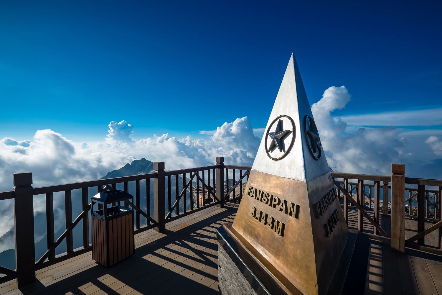
There are two ways to get to Fansipan Peak. One is climbing and the other is riding the cable car. Photo: Shutterstock
September to October is the most beautiful time of the year to climb mountains and hunt clouds. Photo: Leisure By Kris
Pusilung (3,083m)
Suitable for a short trip (02 days 01 night), the route has a moderate length and cannot help but be impressed when owning 03 steep mountains of Pusilung is an "addictive" challenge for many long-time climbers. The road to Pu Si Lung is difficult but also full of poetry. The dirt roads are bright yellow, the width is less than 2m, some sections are less than 1m. One side leans against the mountain, the other side is the smoking abyss, just one minute of absent-mindedness or carelessness, you will be in immediate danger.
Pu Si Lung is a mountain located on the border of Vietnam and China. To get to this mountain in the Vietnamese part, it is necessary to apply for a permit at the Border Guard Command of Lai Chau province in Lai Chau city, then the paper will be reported at the border guard station of Pa Ve Su commune. This post will give people to lead to the mountain. Pu Si Lung is protected and preserved by the people here. The forest for them is really gold, silver. The old forests are kept intact, without any impact. The ancient stumps have been formed for thousands of years, casting shadows that obscure the sun.
Location: Pa Ve Su Commune, Muong Te District, Lai Chau Province - bordering China

A downhill leg at Pusilung. Photo: Khanh Vu Quang
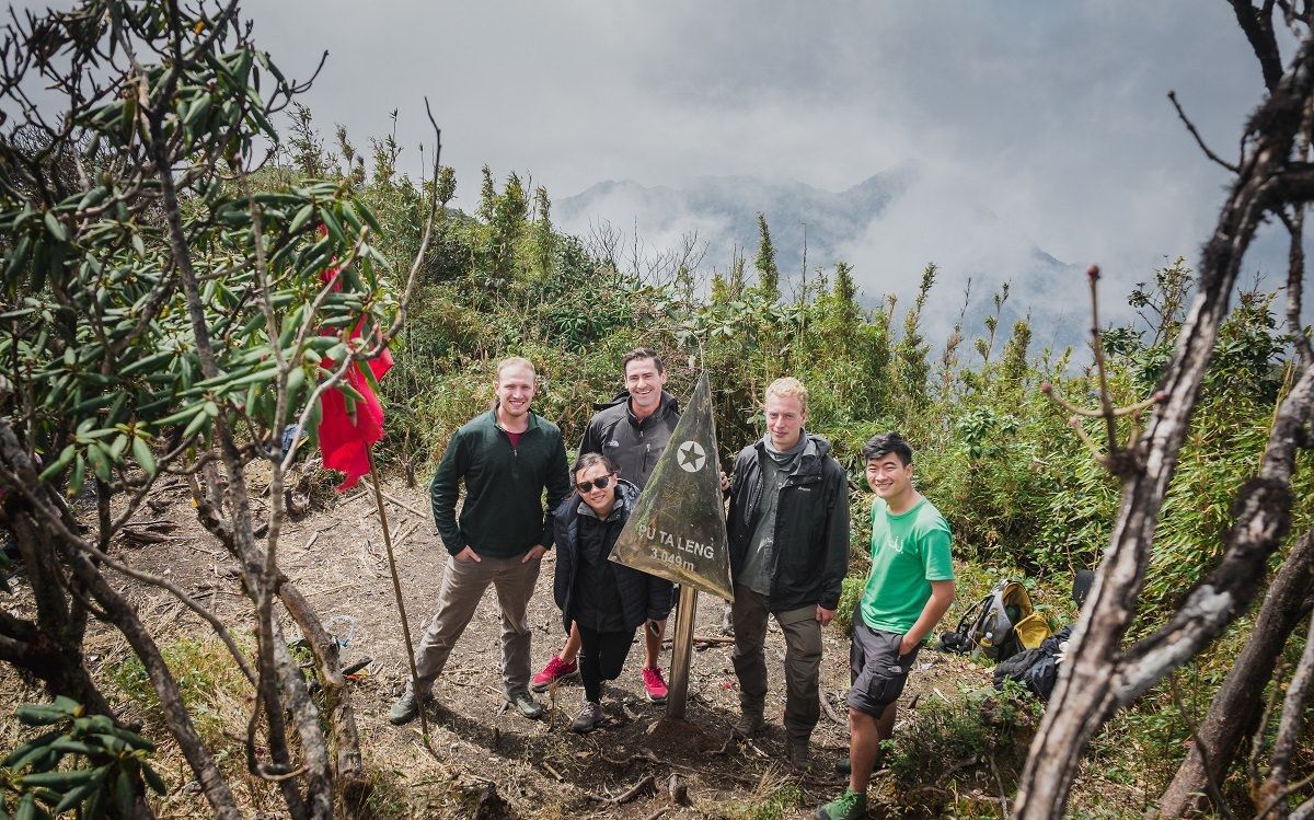
Putaleng (3,049m)
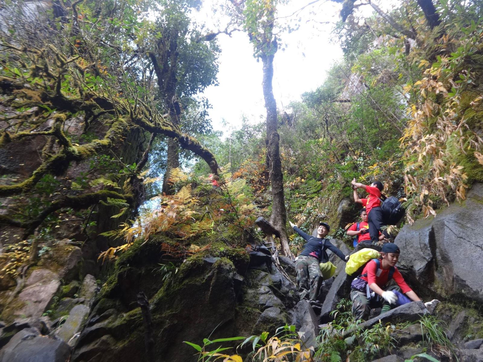
The climbing arc is more than 60km long, the journey through the old forests of Putaleng usually lasts 03 days and 02 nights with many challenging terrains and harshness among the top in the Northwest mountain peak cluster.
To conquer the Putaleng cloud hunting peak, climbers need to be relatively physically fit as well as accustomed to the change of many different terrains - from large and small streams, primeval forests, bamboo forests, oaks and green vegetation. Putaleng is always enjoyed by experienced trekkers when mentioned thanks to its extremely pristine beauty, despite the fact that the name is not as prominent as the Fansipan signs or the Wonders of San/Bach Moc Luong Tu.
Another specialty of Putaleng that you should not miss in the Northwest cloud hunting journey is the rhododendron season that falls in warm March every year.
Location: Ta Leng Commune, Phong Tho District, Lai Chau Province
A favorite trek for climbers. Photo: Hoileonui
Bach Moc Luong Tu (3,046m)
Also known as Ky Quan San, the Bach Moc climbing arc is a great combination of the moderate difficulty of Fansipan and the unique terrain of Putaleng. During the journey of 03 days and two nights, you can go through gentle valleys, steep passes, steep rock slopes, short "spines" enough to watch the clouds on both sides and also "hanging" slopes that have to rely on vines and forest branches to overcome.
During the journey to conquer Bach Moc Luong Tu, you should also not miss the sunrise at Muoi Mountain - a rest stop in the journey of 03 days and 02 nights; Wake up early and try to spend about 10-15 minutes before the journey to see the majesty and peace of the mountains and forests at this vacation spot with a wide view.
Location: Natural boundary between Lai Chau & Lao Cai in Sang Ma Sao commune, Bat Xat district, Lao Cai
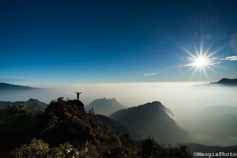
The enchanting scene of the sea of clouds in Bach Moc (Photo: MeogiaPhoto)
Khang Su Van (3,012m)
Only about 20km long, Khang Su Van ranks fifth in the Top 05 highest peaks in Vietnam and is also the shortest climb in the top five. Only exploited and conquered for the first time in 2015, Khang Su Van still retains its pristine beauty with primeval forests, giant ancient trees and moss-covered vegetation.
Khang Su Van is also known as Fan Lien San or U Thai San. The scenery here is mainly cardamom forests and green bamboo, bamboo, and bamboo forests. From February to April, plum blossoms, peach blossoms, and banana flowers bloom all over the mountainside. The trekking route has become more poetic than ever. From the end of April to the beginning of May, azalea forests compete to show off their colors throughout the Northwest mountains. September and October are the times when the air here is extremely fresh. The sky was clear, the sun shone with soft yellow sunlight. The clouds gathered around the top of the mountain are denser by the early autumn chill. This is the ideal time for trekkers to hunt clouds, capturing images like a fairyland.
Completing the journey to the top of Khang Su Van, you can be proud to have passed and conquered border marker 79, the highest milestone in the entire border of Vietnam.
Location: Dao San Commune, Phong Tho District, Lai Chau Province
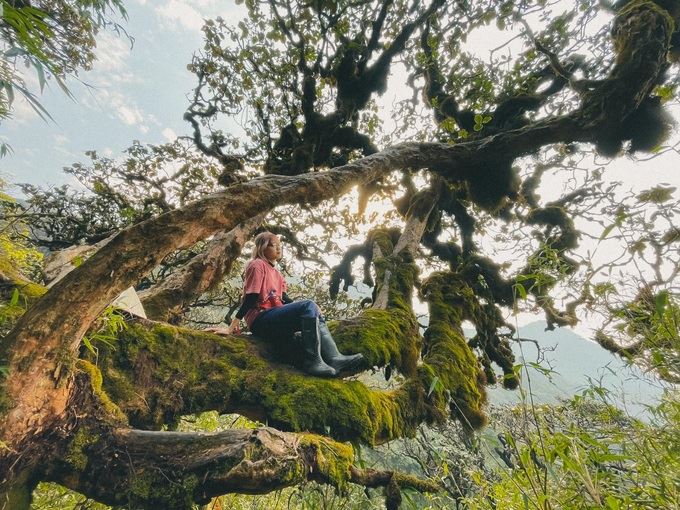
The ancient trees covered with moss are an ideal and unforgettable check-in location. Photo: Hang Bap
Bài Leisure by Kris