Staggering
Lao Tan Mountain, also known as the "Roof of the Y Ty House" (Bat Xat district, Lao Cai) is a complete blend of wild and majestic beauty with the fanciful and magical colors of heaven and earth. Although not as majestic as Fansipan Peak, nor as dangerous as Ba Den Mountain, Lao Tan is famous as the most ideal cloud hunting trekking spot in the Northwest Mountains.
Lao Tan is considered to have moderate difficulty, easy for even beginners in climbing. The foothills of the mountain are mainly low grassy hills, the terrain is not too complicated and near the top, thorny trees and bushes will appear. Along the way, there are also stops for you to rest and explore.
Lao Tan is especially attractive to those who have a hobby of photography. The whole trekking journey is short, but there are many spectacular and impressive views for you to own one-of-a-kind photos.
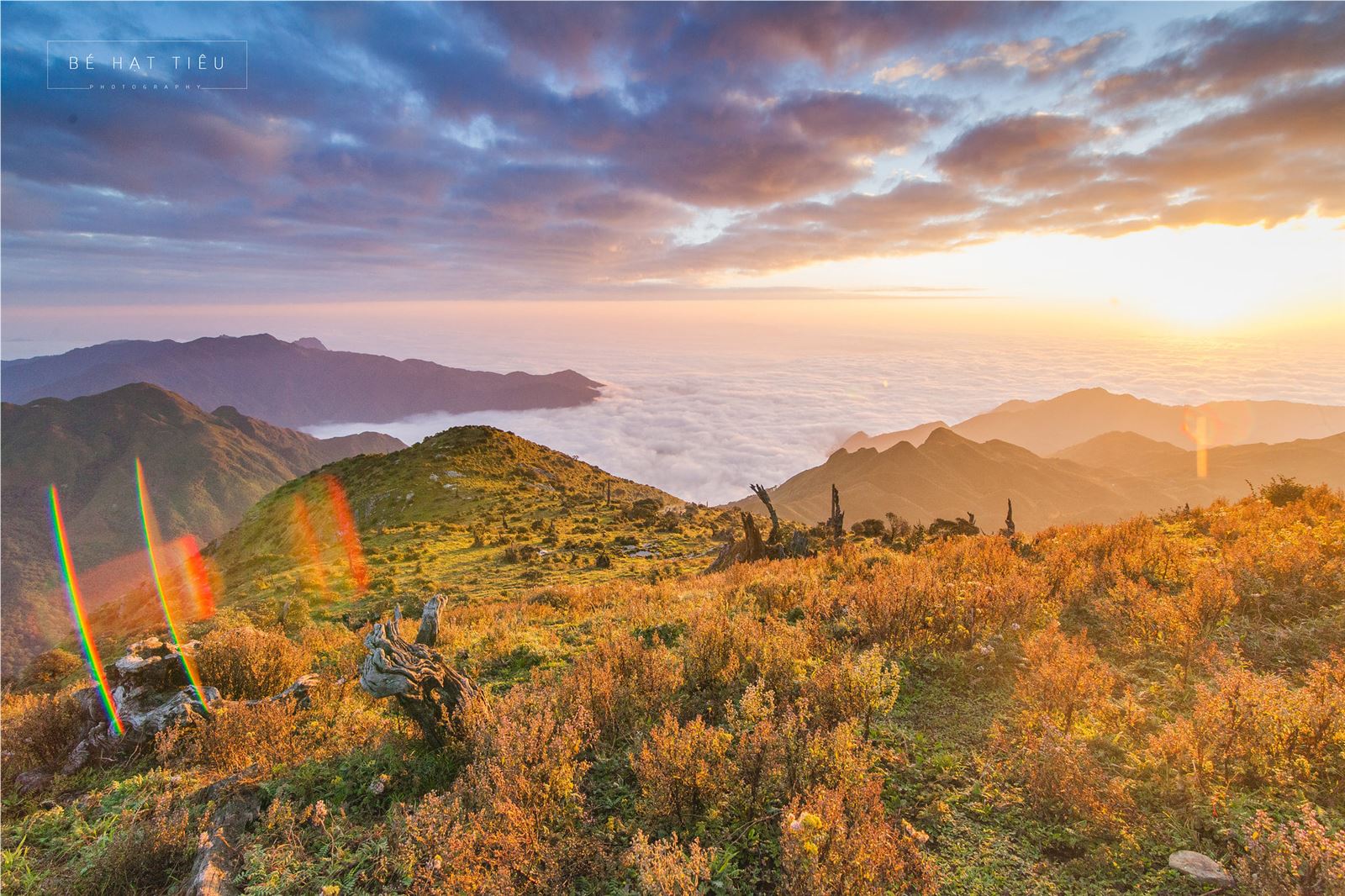
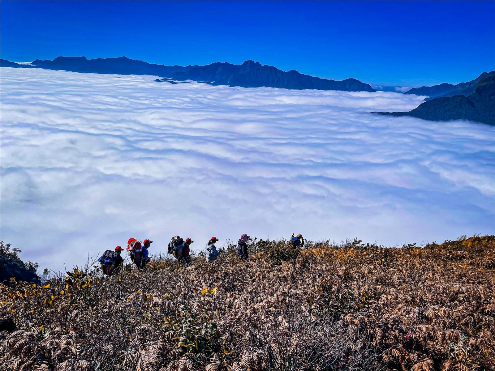
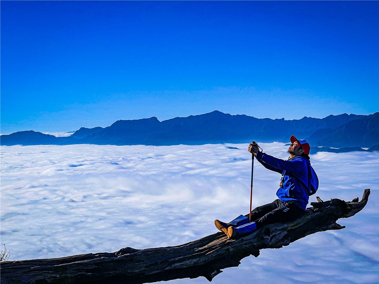
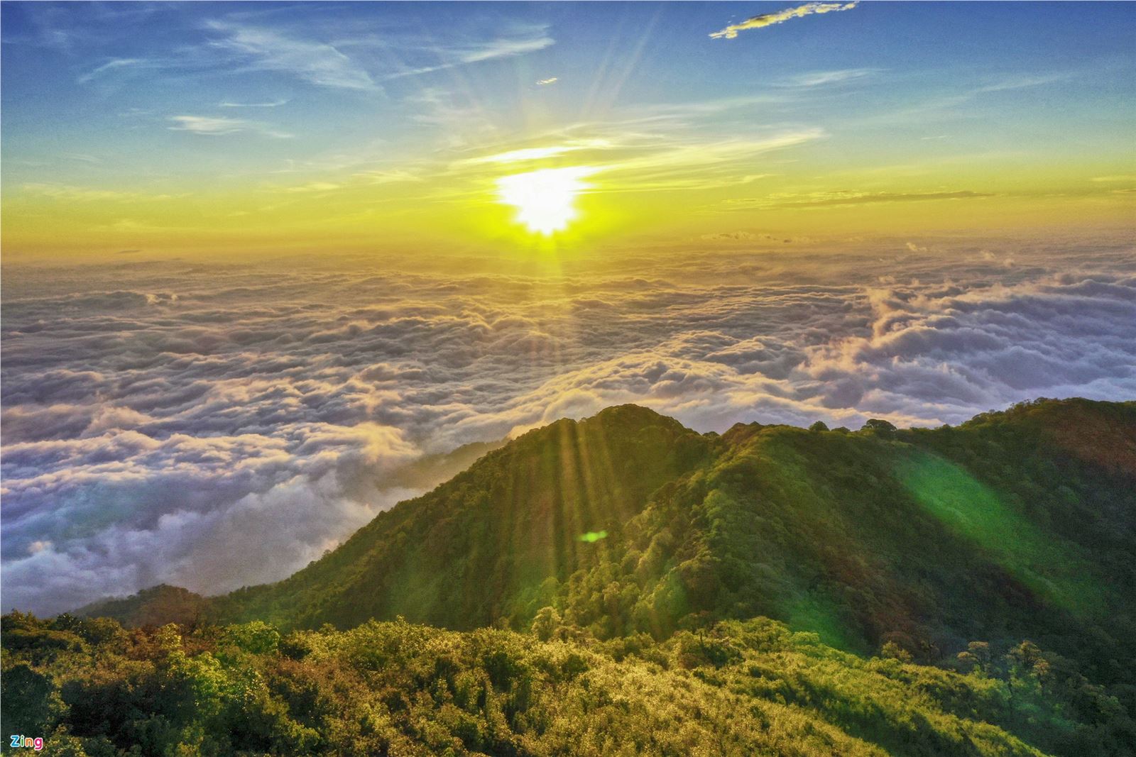
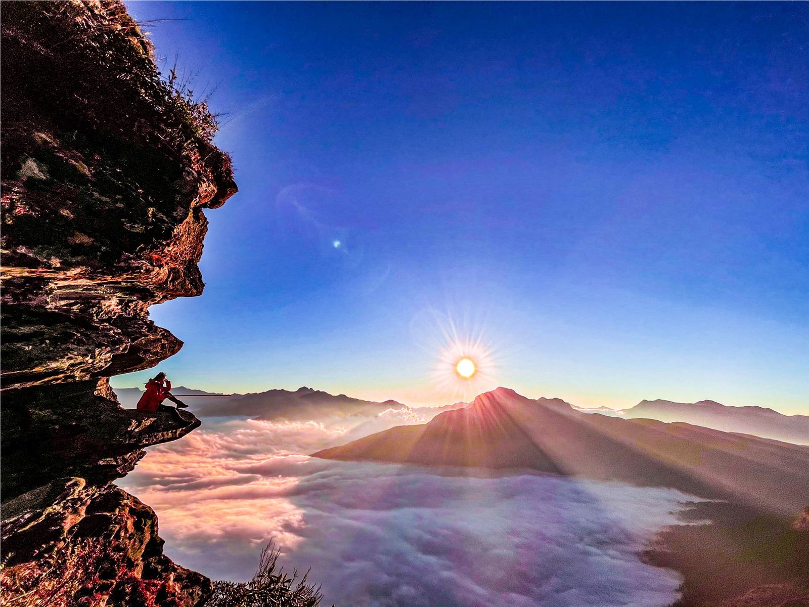
Photo: viettrekking/mia/@imm.thetraveler/checkinVietnam/@trinhdinhthi12
Searching for Offerings
Located at an altitude of 2,913 m, Lung Cung peak is named after a village located deep in the rugged mountains of Nam Co commune, Mu Cang Chai district, about 270 km from Hanoi.
This trek is moderately difficult, the fittest can climb during the day but the majority choose to go for 2 days with a night in a mountain shack. However, to get to the starting point, you need to rent a motorbike to carry 15 km, the muddy road is very difficult to walk, then 11km steep climb to the top.
In return after the hard journeys, the scenery of mountains and forests overlaps with primeval vegetation and many precious herbs. Lung Cung Peak is a flat land of about 1 hectare covered with grass. From here, you can see the whole Lung Cung valley, Che Cu Nha commune of Mu Cang Chai district, and communes of Van Ban district of Lao Cai province.
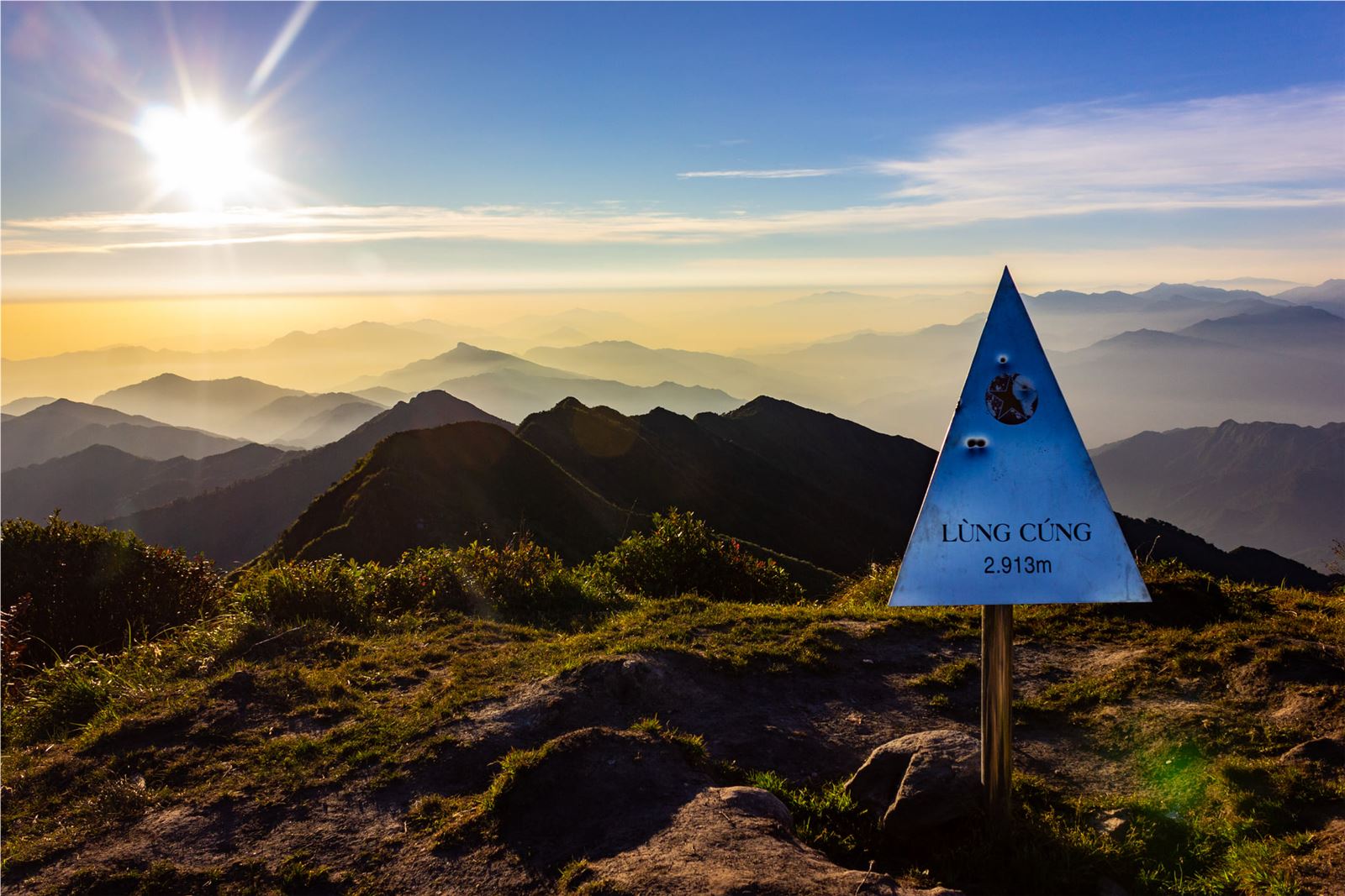
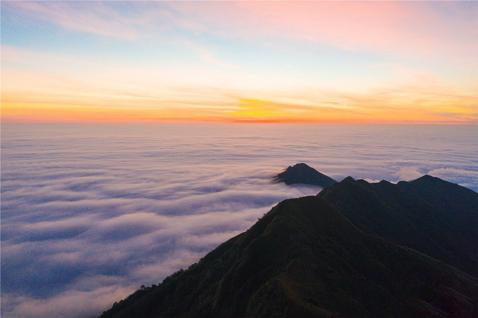
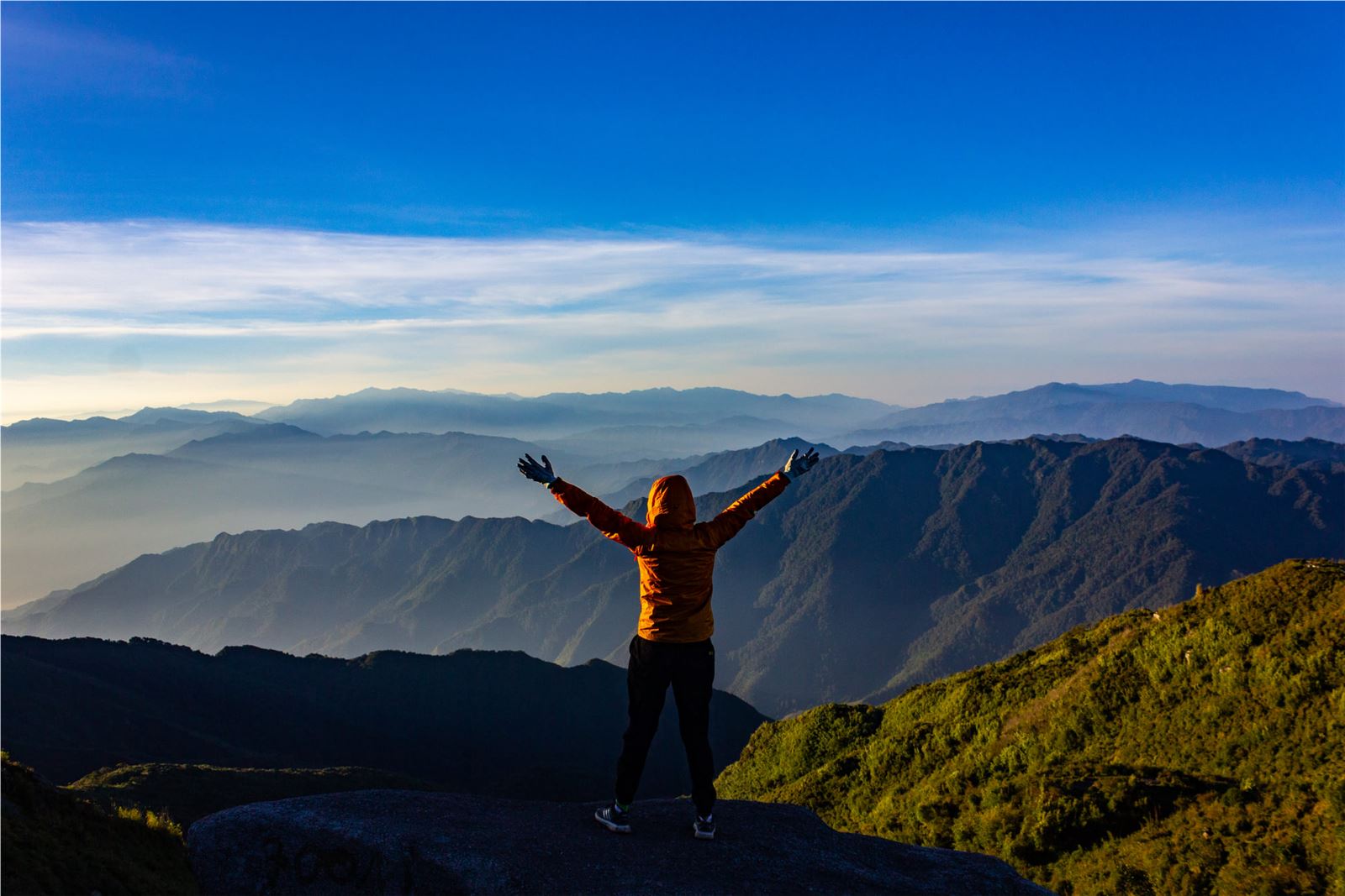
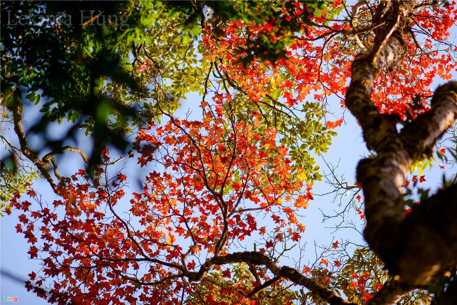
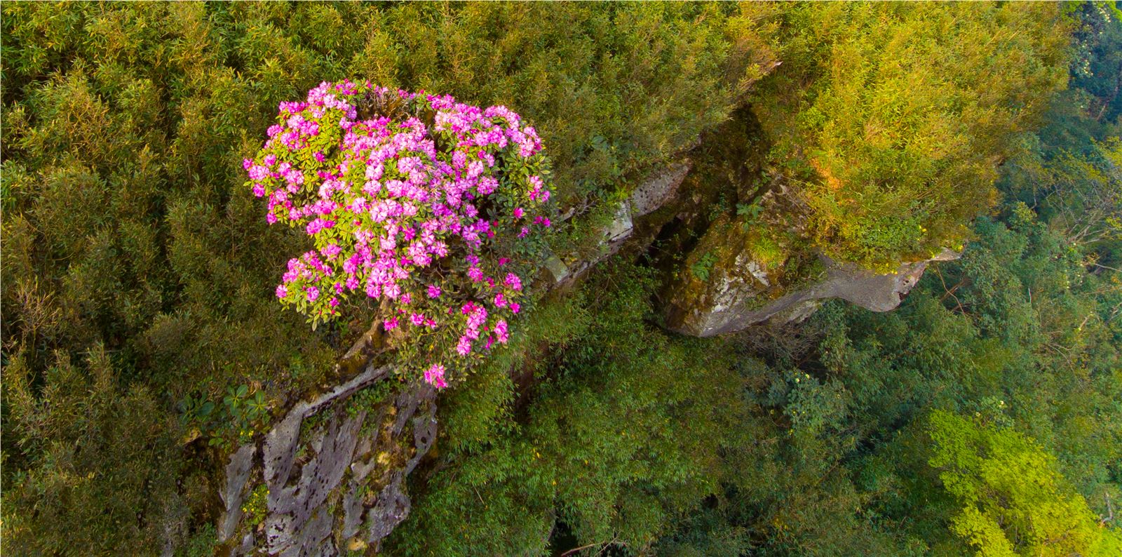
Photo: Mia/Heritage/Zing/Le Duc
Bach Moc Luong Tu
Bach Moc Luong Tu or Ky Quan San with a height of 3,046 m is the second highest mountain in Lao Cai (after Fansipan). From a desolate mountain peak, which was a place for H'Mong people to raise and cultivate crops, in recent years, Bach Moc has become an attractive place for people who like to climb mountains.
It will take you 2-3 days to conquer the road from the foot of the mountain to the top. Currently, there are two directions of climbing, one is from Sang Ma Sao commune, the other is from Den Sung village, Sin Sui Ho commune, Lai Chau. Unlike other mountain ranges with the first section of the road that is easy to walk, Bach Moc Luong Tu peak "preemptively hits" people with consecutive steep slopes, bends and bumps. However, overcoming that thorny and gravel section is a magnificent scene waiting for you.
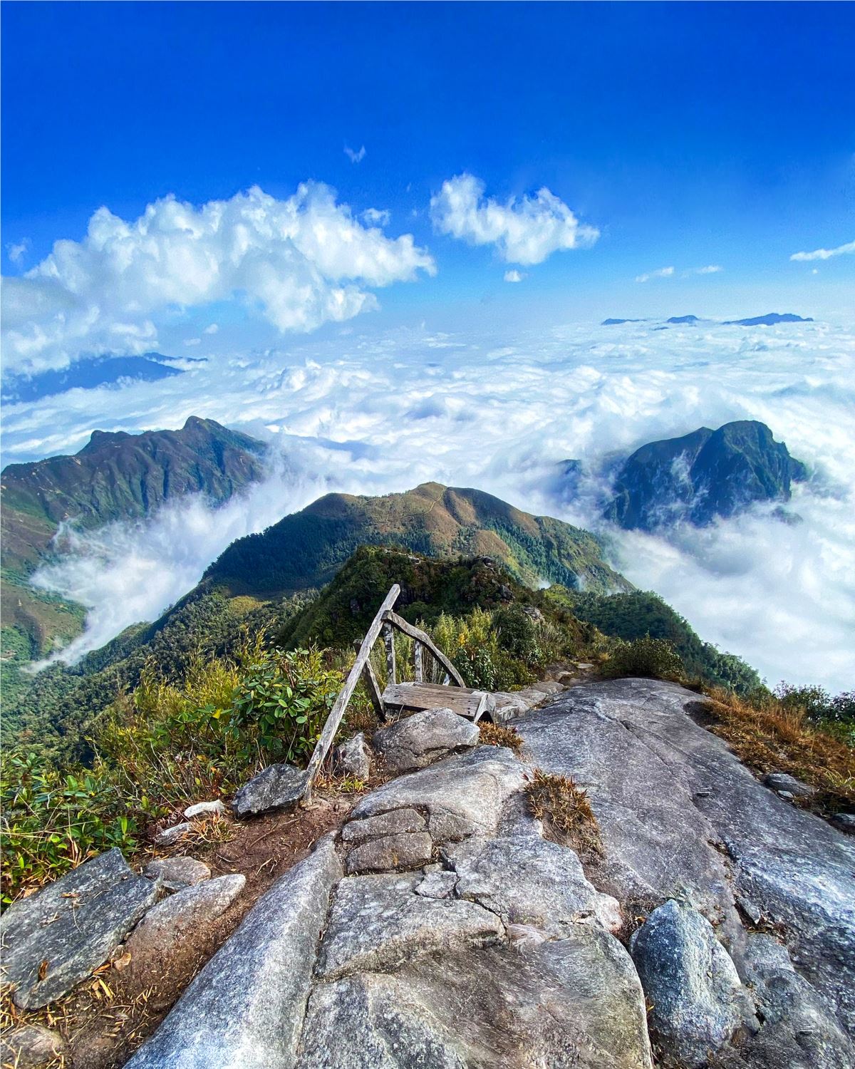
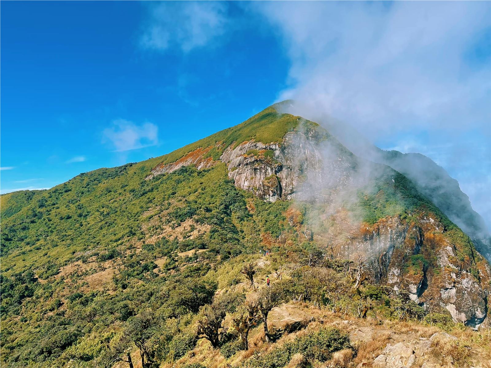
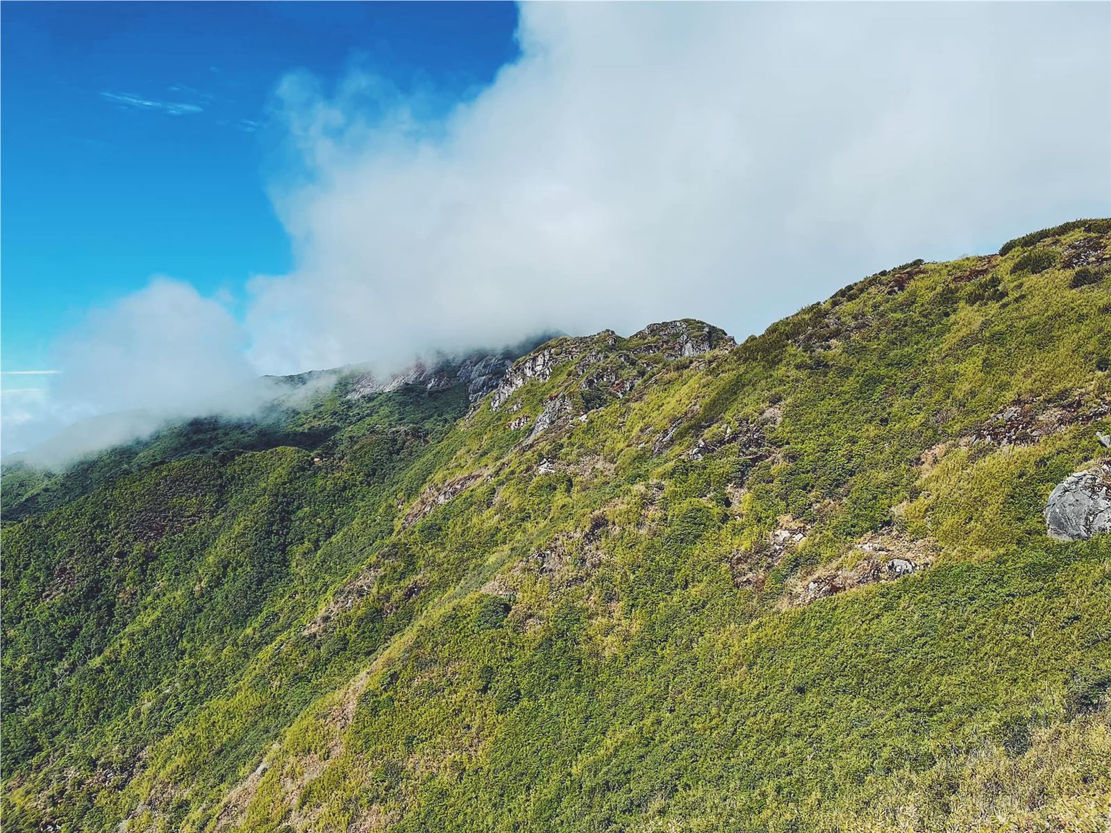
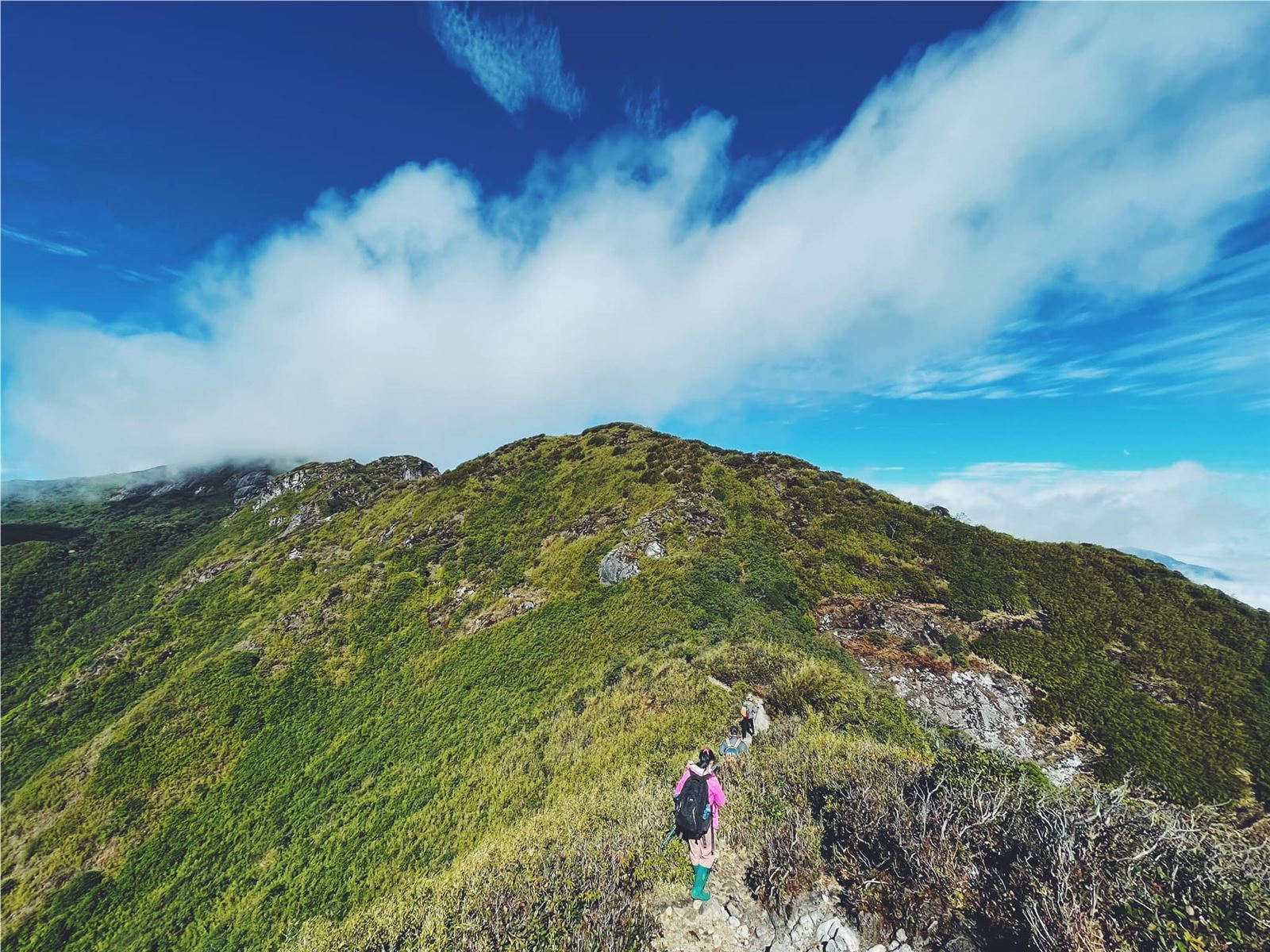
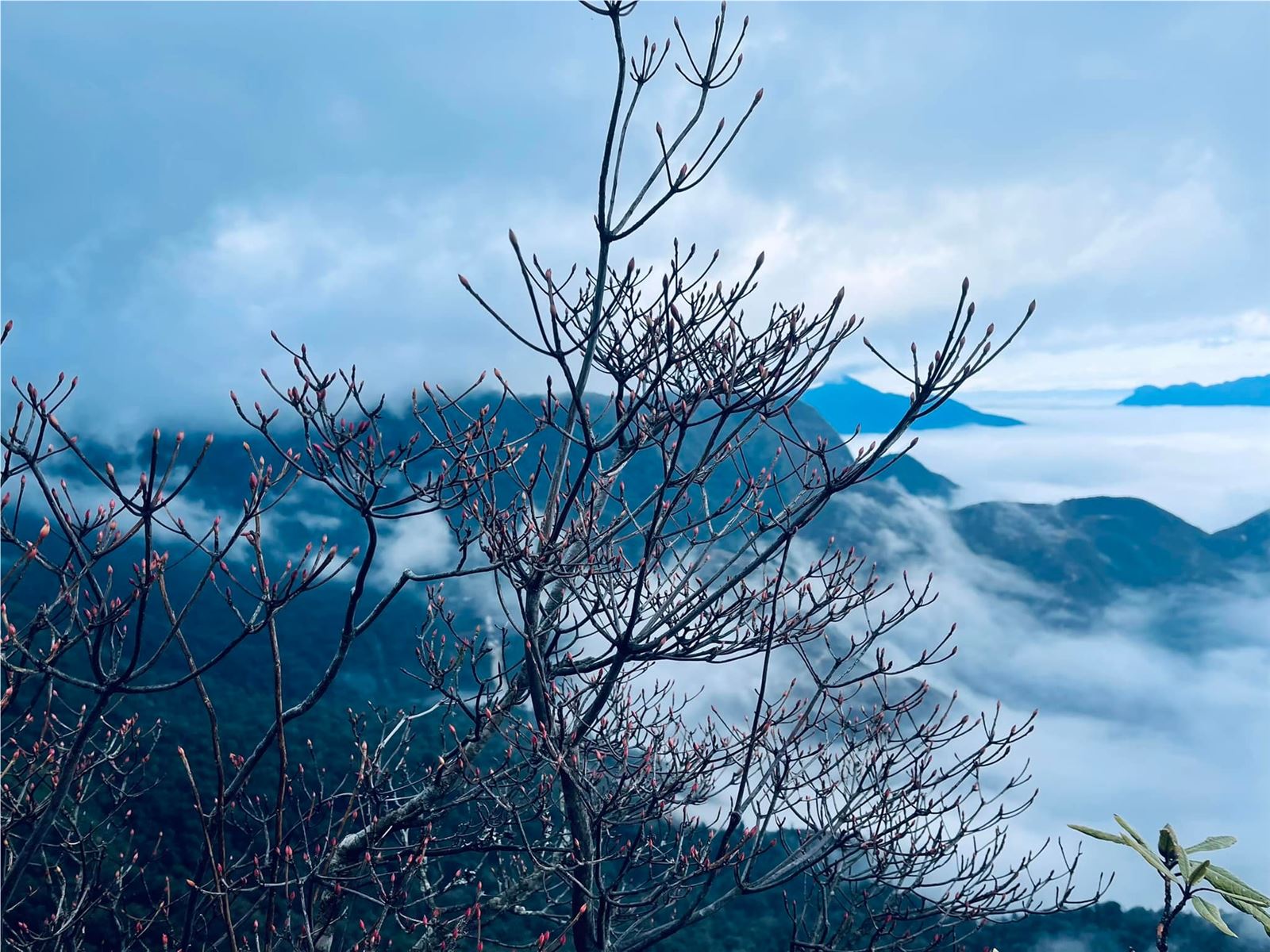
Photo: @Quân Dinh Nguyen/ @Trần Linh/@phaman
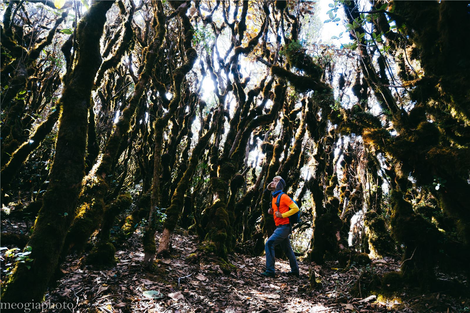
Phia Po
Phia Po Peak, also known as Cha Mountain, is located in the Mau Son mountain complex, nearly 200 km from Hanoi. Located at an altitude of 1,541 m above sea level, Phia Po peak is a new trekking spot on the tourist map, so it retains a lot of wild beauty.
From Hanoi, visitors often choose a schedule of 2 days and 1 night, take a car or motorbike to the foot of the mountain and then hire a guide and porter to accompany them. The journey to conquer Phia Po is divided into 2 stages. On the first day, trekking 3.5 km from the foot of the mountain to the campsite, setting up tents and staying overnight. The second day continued to climb the steep slope to the highest peak of the same length.
The journey is not long, but it passes through diverse forests, streams, and grassy hills with successive steep slopes. In the first days of this year, it will be easy to see the sea of clouds floating on the second stage. Especially when you reach the top, you can also explore the ancient rhododendron forest with green moss right nearby.
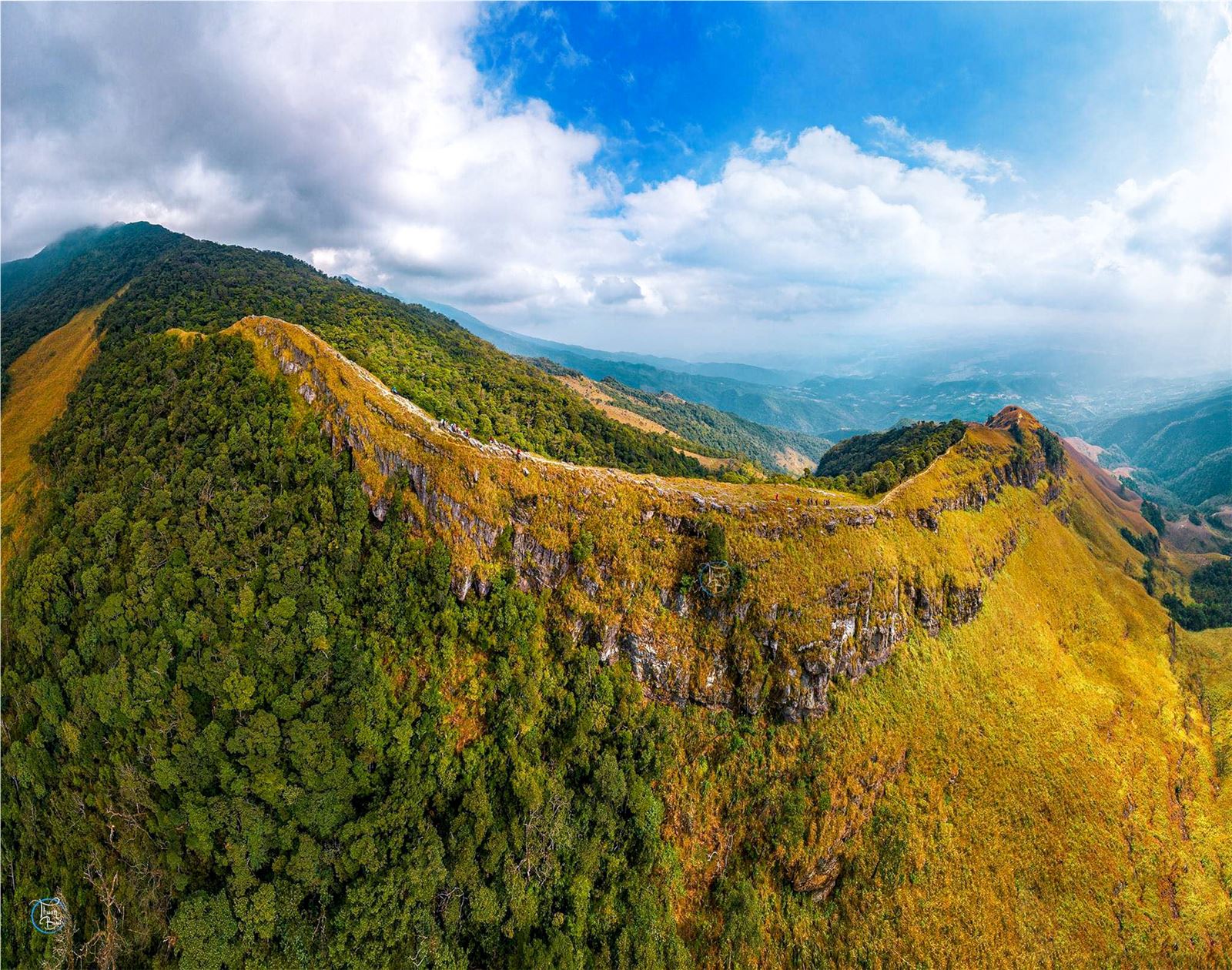
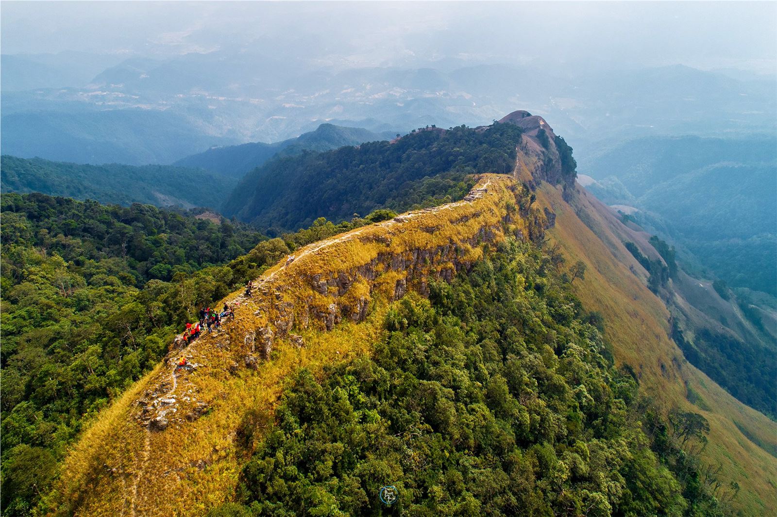
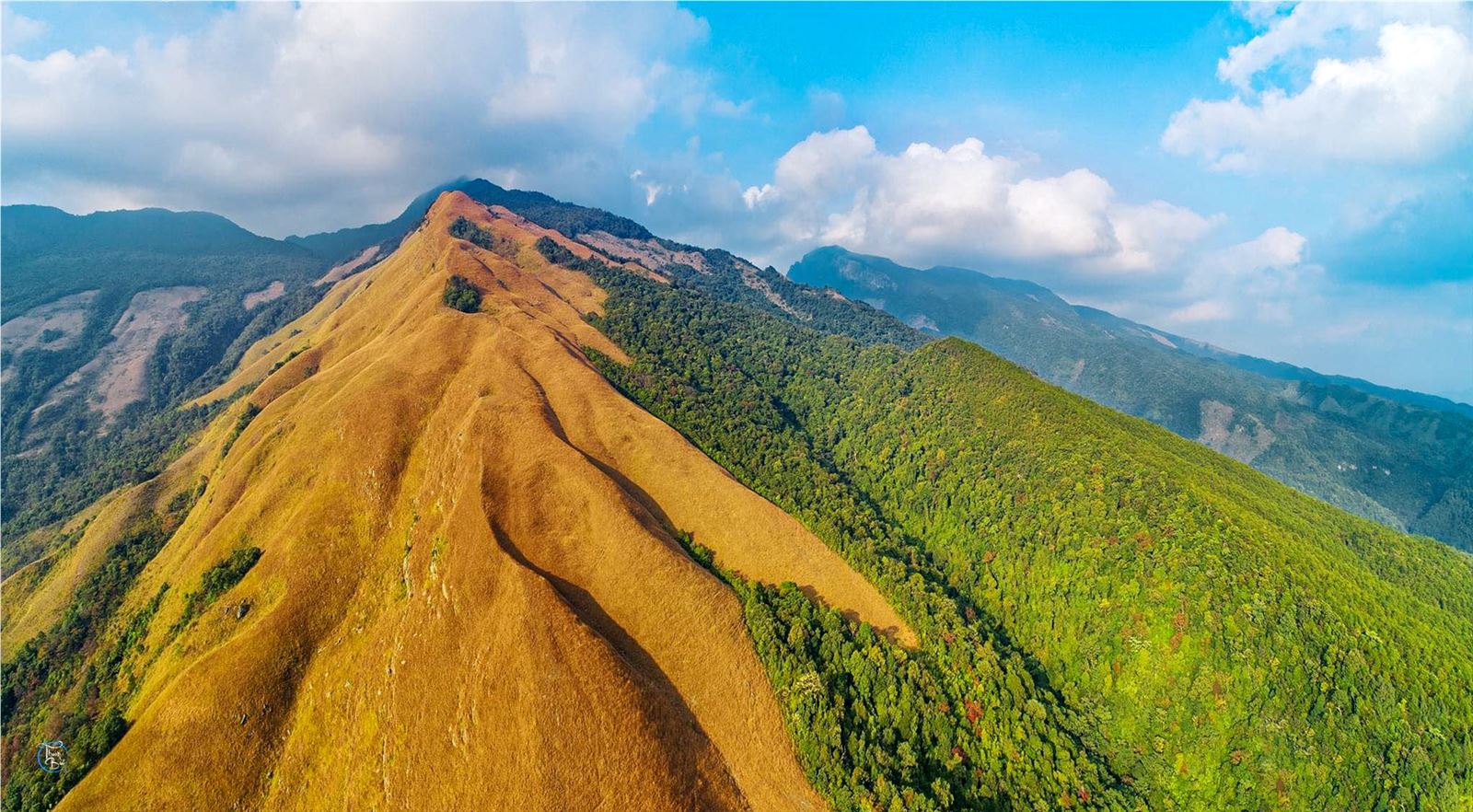
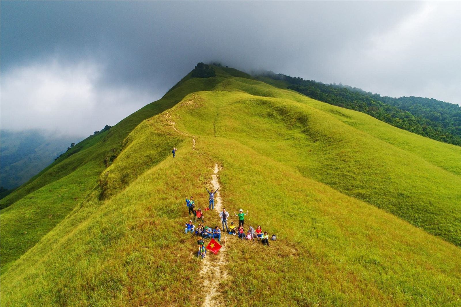
Photo: toquoc.vn/Thuan Bui/ Vietnam Travel
Nhi Co San
The mountain is located in Sang Ma Sao commune, Bat Xat district, Lao Cai province, about 60 km from Sa Pa, Nhi Co San (2,965 m) is the 9th highest mountain peak in Vietnam. Currently, if you want to trek this peak, you usually take a bus to Sa Pa, continue to Den Sang commune, continue to take a motorbike taxi of locals to Nhi Co San village.
The journey to conquer Nhi Co San also lasted 2 days and 1 night, going up in the direction of Ong Chua waterfall and to the goat grazing road of the people or vice versa. On the first day, you will cross many waterfalls, cardamom forests, maples, bamboos... before going to the shack for the night. The second day usually starts from 3-4 am to get to the top in time to catch the sunrise as well as watch the sea of clouds. The climb is of medium difficulty with many slippery slopes, especially after passing Ong Chua waterfall.
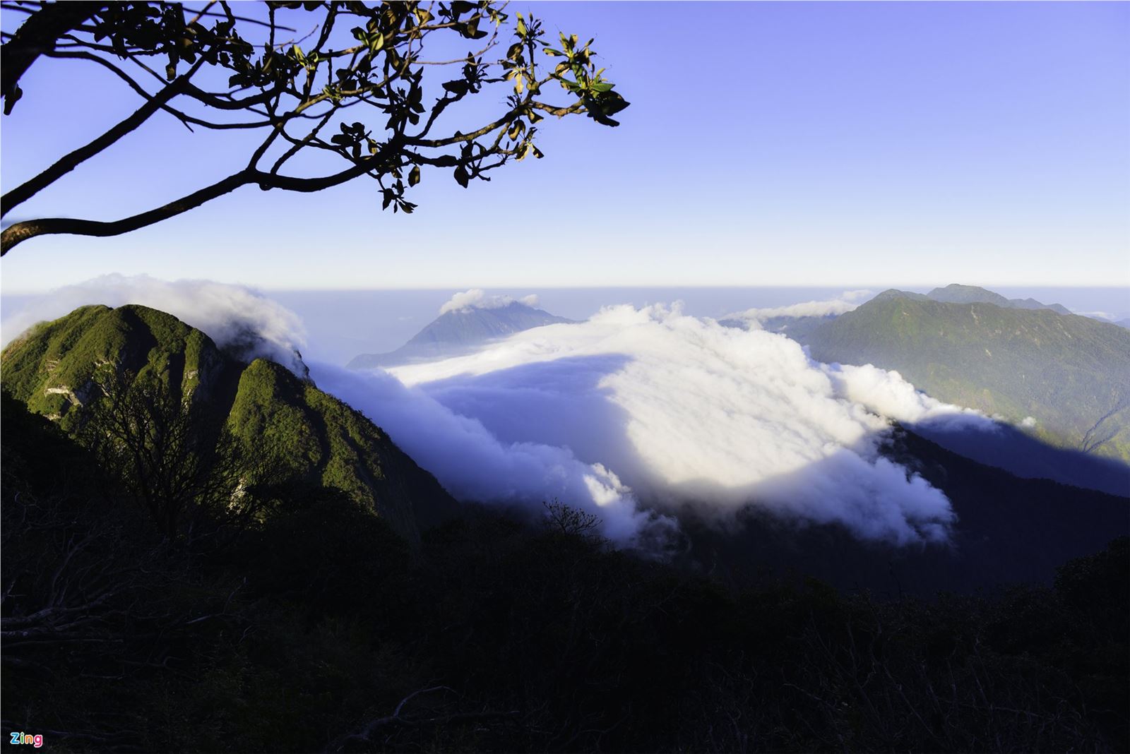
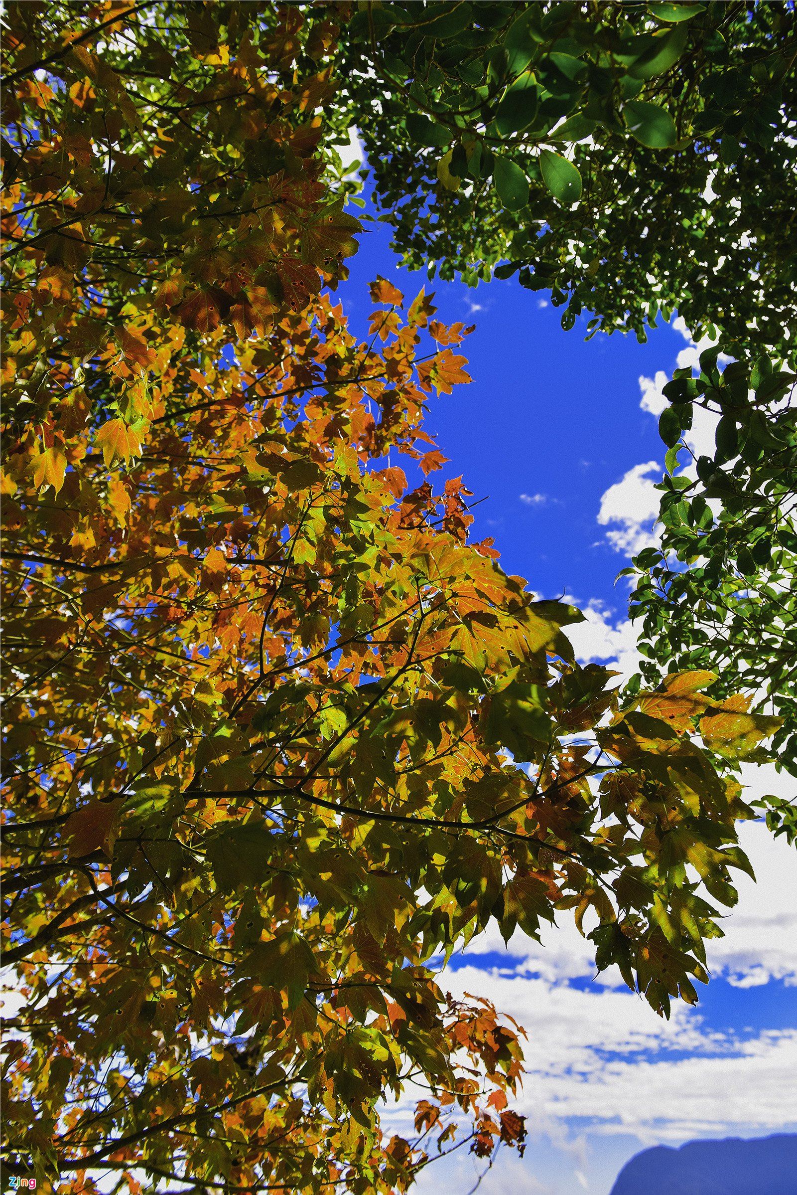
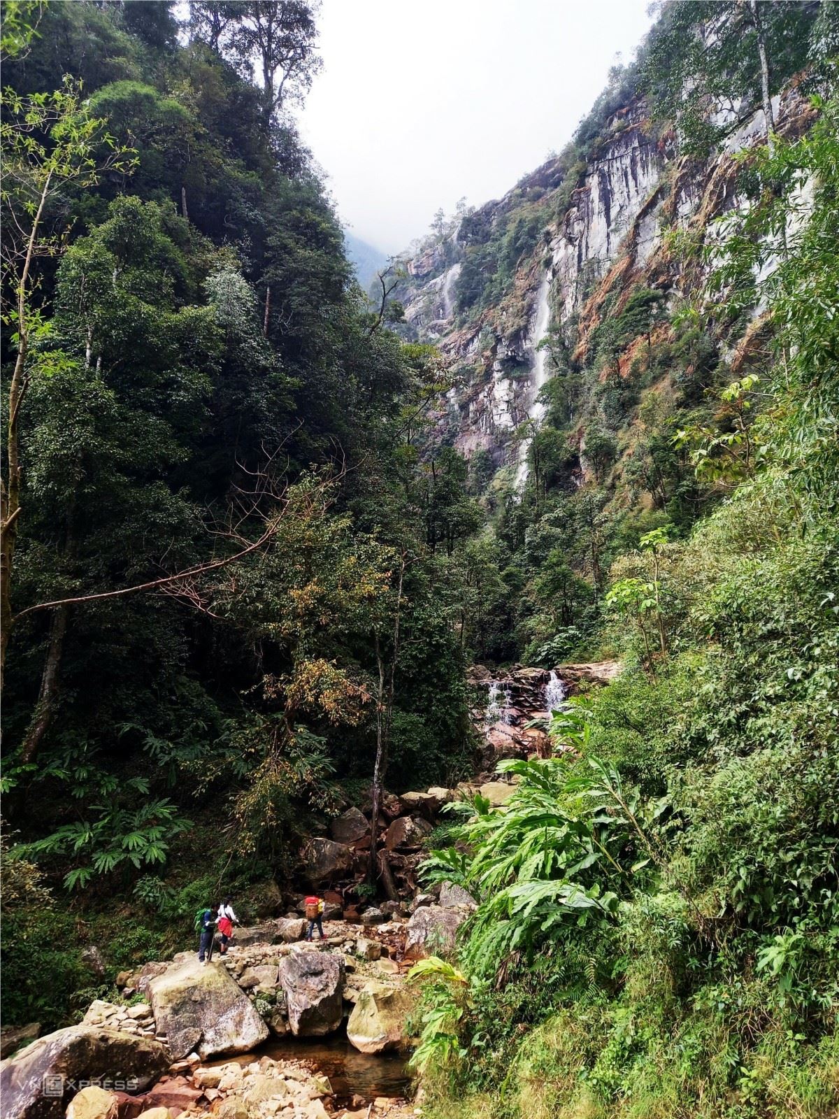
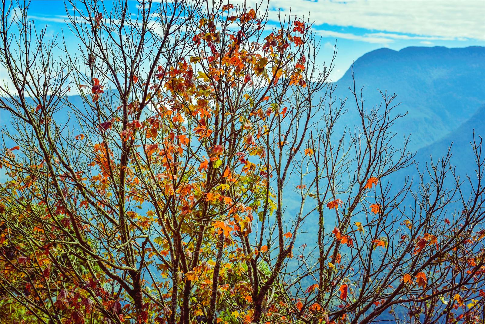
Photo: Zing
Synthetic Migo